The heart of the Nullarbor

Sunset on the Nullarbor

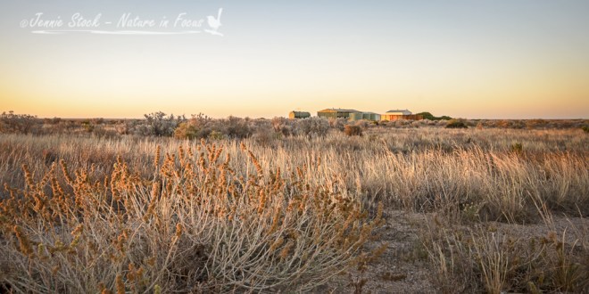
The Nullarbor is most definitely well-named, from the Latin words Nullus arbor, meaning No trees. The seemingly endless flat plain covers an area about the size of the State of Victoria. Once a shallow sea-bed, the Nullarbor is the world’s largest karst landform. South of the Nullarbor is the Great Australian Bight, essentially a very large bay with steep cliff faces. We stopped briefly at a couple of the viewing platforms – with me cursing that the light was in the wrong place for landscape photography – and made it to the Nullarbor Motel just before sunset. Not long before reaching the motel, David and I saw a dingo on the side of the road, and then discovered that the golf hole at the motel was called the Dingo’s Den. Interrupting dinner to take some photos of the sunset, I got another glimpse of a dingo – of course, I had my very wide angle lens one so the dingo is a speck in the distance. He is on the edge of the Royal Flying Doctor Service airstrip; the RFDS is a lifesaver for residents and travelers in the Australian Outback.


Next morning saw the beginning of the last golfing day, with some fun hunting balls around the Dingo’s Den. This was followed by some very hot and dusty holes in places with odd names (Nundroo and Penong). Finally we made it to the golf course in Ceduna for the last two holes! A visit to the Visitor Centre to get the cards signed off (and to David’s relief, to hear that there were much worse scores on record) was followed by a well-deserved 19th hole in the air-conditioned comfort of a Ceduna pub.

Advertisement

Mountains and mountain passes

Tradouw Pass with aloes

There are plenty of mountains and mountain passes in the Western Cape. One of the more interesting passes is the Tradouw Pass, which crosses the Langeberg between Swellendam and Barrydale. Completed in 1873, it was built by convict labour under the direction of road engineer Thomas Bain. During rebuilding in the seventies, several lay-byes were built, making it safer to stop and take photographs. Dramatic red aloes were flowering when we visited. The pass cuts through a section of the Cape Fold Mountains, and the folds and twists in the sandstone are clearly visible. These folds and twists are even more obvious when driving our usual route to Montagu through the Kogmanskloof. Great for impromptu geology lessons!

Du Toitskloof is another awesome pass – it used to be part of the major route into Cape Town from the north but these days there is an impressive tunnel through the mountain that takes most of the traffic. We drove over the top using the old pass very early one misty morning on our way to Franschhoek and stopped a couple of times, resulting in these stitched panoramas.

Looking back towards the Hex River mountains from Du Toitskloof
Looking from Du Toitskloof towards the Hex River mountains

Looking south towards Paarl and Wellington from the top of Du Toitskloof

And then we get to the Western Cape’s most iconic mountain – Table Mountain in all her glory, seen from the V&A Waterfront, a combined tourist attraction and working harbour.
Table Mountain and Devil's Peak on the left, from the waterfront.
Table Mountain and Devil’s Peak on the left, from the waterfront.